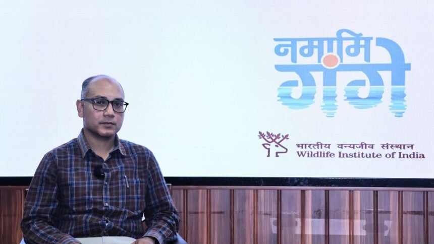
Tech News, Dehradun, 21 April, 2026: In a special dialogue with ‘Radio Kedar,’ Dr. Sk Zeeshan Ali, a Remote Sensing and GIS expert and scientist at the Wildlife Institute of India (WII), explained how Remote Sensing and Geographic Information System (GIS) technologies are acting as a “digital eye” to rejuvenate the Ganga’s ecosystem. He elaborated on how modern technology and local community participation are working together to preserve the river’s habitat.
The Journey of Dr. Zeeshan Ali
Currently working on the Namami Gange Project under the National Mission for Clean Ganga, Dr. Ali’s journey is a testament to scientific curiosity and a dedication to nature. After completing his primary education in Kolkata and an M.Sc. in Environmental Science from Burdwan University, he developed an interest in Remote Sensing and GIS. He furthered his expertise at the Indian Institute of Remote Sensing (IIRS) in Dehradun. Before focusing on Ganga conservation, he made significant contributions to the “All India Tiger Estimation” project at WII.
Understanding the “Digital Eye”
Dr. Ali explained that Remote Sensing allows scientists to obtain accurate information about a place from a distance (via satellites or drones) without physical contact. GIS is the medium used to convert this data into digital maps for scientific analysis.
Habitat Mapping for Dolphins: For a vast area like the 2,525 km flow of the Ganga, this technology monitors every bend and depth. “Probability maps” are prepared based on water depth, flow, and human intervention to identify ideal habitats for the Ganga Dolphin—typically areas with deep water and minimal human activity.
The Concept of “Riverscape”: Dr. Ali clarified that a river is not limited to its two banks. Its existence is tied to a broader area called a “Riverscape,” which includes floodplains and wetlands. These areas are essential habitats for aquatic life and plants, maintaining the river’s health and balance.
Bridging Science and Traditional Knowledge
Dr. Ali shared a profound perspective: the traditional knowledge of local communities is often more valuable than scientific studies alone. While a machine shows the data of today, local elders can describe how the river looked 20–30 years ago and how it has changed over time. True conservation is achieved through “Citizen Science,” where current scientific data meets the historical memory of the people.
Community and Technology: Ganga Praharis
The Ganga Prahari initiative exemplifies this union. These are local volunteers who protect the river at the ground level. GIS is used to track the number of active volunteers in specific states, districts, or blocks and their expertise, allowing for rapid mobilization when conservation work is needed in a specific area.
Challenges and Disaster Management
Working at this scale presents hurdles:
Technical & Policy Barriers: High-quality satellite imagery is expensive and not always freely available. Furthermore, India’s National Geospatial Policy has strict rules regarding mapping areas smaller than 2.25 hectares, and flying drones in sensitive areas requires multiple government permissions.
Disaster Preparedness: In ecologically sensitive states like Uttarakhand, GIS is a lifesaver. Dr. Ali develops “Prediction Models” by analyzing climate data, soil structure, and human settlement patterns to estimate which areas will be affected first during a disaster. It also tracks how dams and barrages change river flow to understand the impact on aquatic habitats.
Career Opportunities for Youth
Dr. Ali encouraged students from Zoology, Botany, Environmental Science, Computer Science, or Geography backgrounds to enter this field.
Specialized Training: WII, in collaboration with the Ministry of Jal Shakti, offers a unique Master’s course in “Freshwater Biodiversity Conservation,” providing integrated training in GIS, Remote Sensing, and biodiversity.
Modern Tools: The integration of Artificial Intelligence (AI) and Machine Learning is making data analysis more precise than ever.
The Path Forward: Citizen Science
Dr. Ali concluded with a vital message: scientists alone cannot save the river. He called for a movement of Citizen Science, where the youth and general public share information about the river via apps and other media. Ganga conservation is not just a project; it is a responsibility toward future generations. Technology is simply the powerful tool that helps fulfill this duty.